TAIPEI GRAND HIKE | taipei grand trail

InSeptember2018,theGeotechnicalEngineeringOfficeofthePublicWorksDepartmentofTaipeiCityGovernmentannouncedtheopeningoftheTaipeiGrandHike.Thisisa92kmroutethroughsomeofTaipei’smostsceniclandscapeandoversomeofitsmostpopularpeaks.Thehiketakesinexistingtrailsandroads,butnewsignsandfacilitieshavebeeninstalledalongtheroutetomakesurethathikerscancomfortablyaccessthelandscape.Aswellascoveringatotaldistanceof92km,thereisanelevationdifferentialof1120m,andaccordingtotheinformationonthetrail’sofficialmapy...

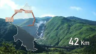
In September 2018, the Geotechnical Engineering Office of the Public Works Department of Taipei City Government announced the opening of the Taipei Grand Hike. This is a 92km route through some of Taipei’s most scenic landscape and over some of its most popular peaks. The hike takes in existing trails and roads, but new signs and facilities have been installed along the route to make sure that hikers can comfortably access the landscape. As well as covering a total distance of 92km, there is an elevation differential of 1120m, and according to the information on the trail’s official map you are likely to burn off upwards of 38,000 calories in the process of covering the miles.
Anyone wishing to pick up a map of the whole route can head to the GEO office during office hours at: 3rd Fl., No. [1]300, Son[2]gde Rd. ([3]松德路[4]), Xinyi Dist., Taipei City[5]. (It would be great if these maps were more widely available.)
The whole route walk is split into seve...